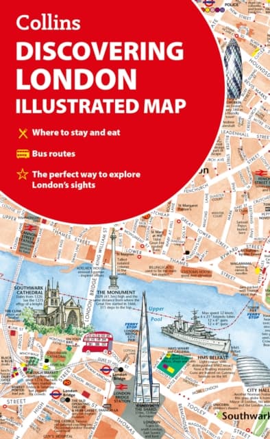
Discovering London Illustrated Map
17,21 €
17,21 €
Varastossa
Pe, 23 loka - ti, 27 loka
Kotiinkuljetus
Turvallinen maksaminen
14 päivää avoin osto
Myyjä ja toimittaja
Tuotteen kuvaus
A new edition of London’s most original map. This hand-watercoloured map contains individual paintings of all the main sites and landmarks, shop-by-shop street maps, theatres and cinemas, comprehensive travel information and index. This detailed map of Central London is at a scale of 1:8,250 (7.5 inches to 1 mile). Coverage extends from Regent’s Park in the north to Battersea in the south, and from Kensington in the west to Tower Bridge in the east. This attractive and fact-filled map would make a lovely souvenir for the visitor to London. The map features: Railway stations, bus routes, London underground map, taxi ranks and car parksShop-by-shop street maps for Oxford Street, Bond Street, Covent Garden, Portobello Road, King’s Road, Brompton Cross, Exmouth Market, Beauchamp Place, St. Christopher’s Place and South Molton Street, Knightsbridge, Jermyn Street and KensingtonLondon’s theatres and cinemasPlaces to eat, internet cafés and good places for a picnicAn inset map of the City of LondonComprehensive indexHistorical and contemporary anecdotes Other titles in the series: Discovering EdinburghDiscovering Glasgow
Tuotenro
5e0ebcf9-32a0-5ea8-ad7c-10726b9d8894
Kirjan tiedot | |
|---|---|
Formaatti | Unknown |
Kieli | English |
Sivumäärä | 2 |
Julkaisupäivä | 2025-03-27 |
Kustantaja | HarperCollins Publishers |
Tekijät | Collins Maps and Collins Maps, |
Mitat | 202 × 114 × 3 mm |
Paino | 70 g |
ISBN | 9780008724658 |
Alkuperämaa | GB |
Discovering London Illustrated Map
17,21 €
17,21 €
Varastossa
Pe, 23 loka - ti, 27 loka
Kotiinkuljetus
Turvallinen maksaminen
14 päivää avoin osto
Myyjä ja toimittaja